Search for Grid Square by Postcode
SK89
Based in the East Midlands English Region & Yorkshire and the Humber English Region.
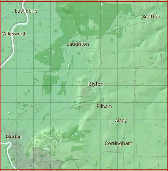
The SK89 10 square kilometre grid intersects with the settlements of Aisby,Blyton,Corringham,Gainsborough,Laughton,Northorpe,Owston Ferry,Scotton & Wildsworth.
SK89
SK89 is within the post towns of Doncaster, Yorkshire & Gainsborough, Lincolnshire.
The square is within Bassetlaw District, North Lincolnshire & West Lindsey District councils.
The SK89 national grid square measures 10 km by 10 km and has an area of 1,000 kilometres squared.
The technical term for a 10 km map square is a Hectad.
When this 10 km square is divided into a grid 10 by 10 it gives the next size of grid square. This unit is called a Monad and measures 1km square. 100 monads fit in a 10km square.
Out of the monads generated from square SK89, 523 are land and -423 are sea. Sea squares are disregarded on this site as they contain no land features.
|
|
|
|
|
|
 |
|
|
|
|
|
 |  |  |  |  |  |  |  |  |  |
 |  |  |  |  |  |  |  |  |  |
 |  |  |  |  |  |  |  |  |  |
 |  |  |  |  |  |  |  |  |  |
 |  |  |  |  |  |  |  |  |  |
 |  |  |  |  |  |  |  |  |  |
 |  |  |  |  |  |  |  |  |  |
 |  |  |  |  |  |  |  |  |  |
 |  |  |  |  |  |  |  |  |  |
 |  |  |  |  |  |  |  |  |  |
| Corner | Latitude | Longitude | Easting | Northing |
|---|---|---|---|---|
| South West Corner | 53.399187 | -0.798239 | 480000 | 390000 |
| South East Corner | 53.399187 | -0.645024 | 490000 | 390000 |
| North West Corner | 53.490658 | -0.798239 | 480000 | 400000 |
| North East Corner | 53.490658 | -0.645024 | 490000 | 400000 |