Search for Grid Square by Postcode
SK99
Based in the East Midlands English Region & Yorkshire and the Humber English Region.
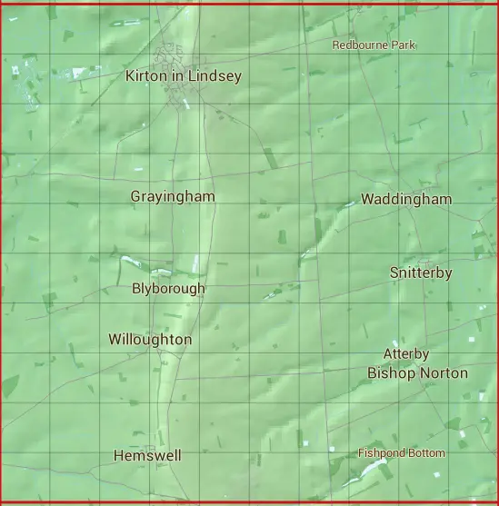
The SK99 10 square kilometre grid intersects with the settlements of Bishop Norton,Blyborough,Glentham,Grayingham,Harpswell,Hemswell,Hemswell Cliff,Kirton in Lindsey,Redbourne,Snitterby,Waddingham & Willoughton.
SK99
SK99 is within the post towns of Gainsborough, Lincolnshire & Market Rasen, Lincolnshire.
The square is within North Lincolnshire & West Lindsey District councils.
The SK99 national grid square measures 10 km by 10 km and has an area of 1,000 kilometres squared.
The technical term for a 10 km map square is a Hectad.
When this 10 km square is divided into a grid 10 by 10 it gives the next size of grid square. This unit is called a Monad and measures 1km square. 100 monads fit in a 10km square.
Out of the monads generated from square SK99, 1900 are land and -1800 are sea. Sea squares are disregarded on this site as they contain no land features.
|
|
|
|
|
|
 |
|
|
|
|
|
 |  |  |  |  |  |  |  |  |  |
 |  |  |  |  |  |  |  |  |  |
 |  |  |  |  |  |  |  |  |  |
 |  |  |  |  |  |  |  |  |  |
 |  |  |  |  |  |  |  |  |  |
 |  |  |  |  |  |  |  |  |  |
 |  |  |  |  |  |  |  |  |  |
 |  |  |  |  |  |  |  |  |  |
 |  |  |  |  |  |  |  |  |  |
 |  |  |  |  |  |  |  |  |  |
| Corner | Latitude | Longitude | Easting | Northing |
|---|---|---|---|---|
| South West Corner | 53.397390 | -0.647880 | 490000 | 390000 |
| South East Corner | 53.397390 | -0.494362 | 500000 | 390000 |
| North West Corner | 53.489046 | -0.647880 | 490000 | 400000 |
| North East Corner | 53.489046 | -0.494362 | 500000 | 400000 |