Search for Grid Square by Postcode
SE90
Based in the East Midlands English Region & Yorkshire and the Humber English Region.
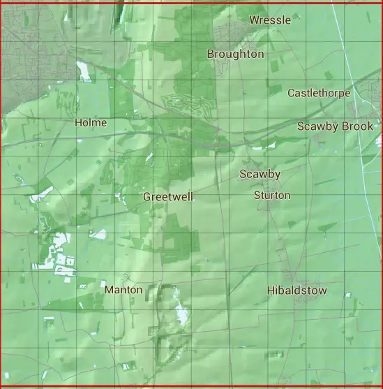
The SE90 10 square kilometre grid intersects with the settlements of Brigg,Broughton,Greetwell,Hibaldstow,Messingham,Redbourne,Scawby,Scawby Brook,Scunthorpe,Scunthorpe Steel Works & Wressle.
SE90
SE90 is within the post towns of Brigg, Lincolnshire, Gainsborough, Lincolnshire & Scunthorpe, Lincolnshire.
The square is within North Lincolnshire & West Lindsey District councils.
The SE90 national grid square measures 10 km by 10 km and has an area of 1,000 kilometres squared.
The technical term for a 10 km map square is a Hectad.
When this 10 km square is divided into a grid 10 by 10 it gives the next size of grid square. This unit is called a Monad and measures 1km square. 100 monads fit in a 10km square.
Out of the monads generated from square SE90, 523 are land and -423 are sea. Sea squares are disregarded on this site as they contain no land features.
|
|
|
|
|
|
 |
|
|
|
|
|
 |  |  |  |  |  |  |  |  |  |
 |  |  |  |  |  |  |  |  |  |
 |  |  |  |  |  |  |  |  |  |
 |  |  |  |  |  |  |  |  |  |
 |  |  |  |  |  |  |  |  |  |
 |  |  |  |  |  |  |  |  |  |
 |  |  |  |  |  |  |  |  |  |
 |  |  |  |  |  |  |  |  |  |
 |  |  |  |  |  |  |  |  |  |
 |  |  |  |  |  |  |  |  |  |
| Corner | Latitude | Longitude | Easting | Northing |
|---|---|---|---|---|
| South West Corner | 53.487243 | -0.645024 | 490000 | 400000 |
| South East Corner | 53.487243 | -0.491173 | 500000 | 400000 |
| North West Corner | 53.578904 | -0.645024 | 490000 | 410000 |
| North East Corner | 53.578904 | -0.491173 | 500000 | 410000 |