Search for Grid Square by Postcode
SU26
Based in the South East English Region & South West English Region.
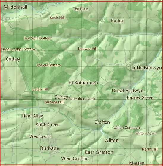
The SU26 10 square kilometre grid intersects with the settlements of Axford,Burbage,Chisbury,East Grafton,Easton Royal,Froxfield,Great Bedwyn,Little Bedwyn,Marlborough,Mildenhall,Stitchcombe,Wilton & Wootton Rivers.
SU26
SU26 is within the post towns of Hungerford, Berkshire, Marlborough, Wiltshire & Pewsey, Wiltshire.
The square is within West Berkshire & Wiltshire councils.
The SU26 national grid square measures 10 km by 10 km and has an area of 1,000 kilometres squared.
The technical term for a 10 km map square is a Hectad.
When this 10 km square is divided into a grid 10 by 10 it gives the next size of grid square. This unit is called a Monad and measures 1km square. 100 monads fit in a 10km square.
Out of the monads generated from square SU26, 525 are land and -425 are sea. Sea squares are disregarded on this site as they contain no land features.
|
|
|
|
|
|
 |
|
|
|
|
|
 |  |  |  |  |  |  |  |  |  |
 |  |  |  |  |  |  |  |  |  |
 |  |  |  |  |  |  |  |  |  |
 |  |  |  |  |  |  |  |  |  |
 |  |  |  |  |  |  |  |  |  |
 |  |  |  |  |  |  |  |  |  |
 |  |  |  |  |  |  |  |  |  |
 |  |  |  |  |  |  |  |  |  |
 |  |  |  |  |  |  |  |  |  |
 |  |  |  |  |  |  |  |  |  |
| Corner | Latitude | Longitude | Easting | Northing |
|---|---|---|---|---|
| South West Corner | 51.338300 | -1.714264 | 420000 | 160000 |
| South East Corner | 51.338300 | -1.569867 | 430000 | 160000 |
| North West Corner | 51.428655 | -1.714264 | 420000 | 170000 |
| North East Corner | 51.428655 | -1.569867 | 430000 | 170000 |