Search for Grid Square by Postcode
ST38
Based in the South Wales East region of Scotland.
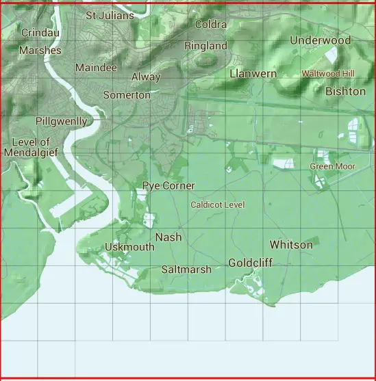
The ST38 10 square kilometre grid intersects with the settlements of Bishton,Broadstreet Common,Caerllion,Goldcliff,Langstone,Llanmartin,Llanwern,Nash,Newport,Pye Corner,Saltmarsh,Underwood & Whitson.
ST38
ST38 is within the post towns of Caldicot, Monmouthshire & Newport, Monmouthshire.
The square is within Casnewydd - Newport council.
The ST38 national grid square measures 10 km by 10 km and has an area of 1,000 kilometres squared.
The technical term for a 10 km map square is a Hectad.
When this 10 km square is divided into a grid 10 by 10 it gives the next size of grid square. This unit is called a Monad and measures 1km square. 100 monads fit in a 10km square.
Out of the monads generated from square ST38, 487 are land and -387 are sea. Sea squares are disregarded on this site as they contain no land features.
|
|
|
|
|
|
 |
|
|
|
|
|
 |  |  |  |  |  |  |  |  |  |
 |  |  |  |  |  |  |  |  |  |
 |  |  |  |  |  |  |  |  |  |
 |  |  |  |  |  |  |  |  |  |
 |  |  |  |  |  |  |  |  |  |
 |  |  |  |  |  |  |  |  |  |
 |  |  |  |  |  |  |  |  |  |
 |  |  |  |  |  |  |  |  |  |
 |  |  |  |  |  |  |  |  | |
 |  |
| Corner | Latitude | Longitude | Easting | Northing |
|---|---|---|---|---|
| South West Corner | 51.514569 | -3.012158 | 330000 | 180000 |
| South East Corner | 51.514569 | -2.866072 | 340000 | 180000 |
| North West Corner | 51.605626 | -3.012158 | 330000 | 190000 |
| North East Corner | 51.605626 | -2.866072 | 340000 | 190000 |