Search for Grid Square by Postcode
SS31
Based in the South West English Region.
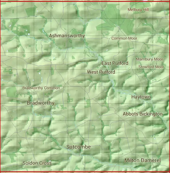
The SS31 10 square kilometre grid intersects with the settlements of Bradworthy,Milton Damerel,Sutcombe & West Putford.
SS31
SS31 is within the post towns of Bideford, Devon & Holsworthy, Devon.
The square is within Torridge District council.
The SS31 national grid square measures 10 km by 10 km and has an area of 1,000 kilometres squared.
The technical term for a 10 km map square is a Hectad.
When this 10 km square is divided into a grid 10 by 10 it gives the next size of grid square. This unit is called a Monad and measures 1km square. 100 monads fit in a 10km square.
Out of the monads generated from square SS31, 339 are land and -239 are sea. Sea squares are disregarded on this site as they contain no land features.
|
|
|
|
|
|
 |
|
|
|
|
|
 |  |  |  |  |  |  |  |  |  |
 |  |  |  |  |  |  |  |  |  |
 |  |  |  |  |  |  |  |  |  |
 |  |  |  |  |  |  |  |  |  |
 |  |  |  |  |  |  |  |  |  |
 |  |  |  |  |  |  |  |  |  |
 |  |  |  |  |  |  |  |  |  |
 |  |  |  |  |  |  |  |  |  |
 |  |  |  |  |  |  |  |  |  |
 |  |  |  |  |  |  |  |  |  |
| Corner | Latitude | Longitude | Easting | Northing |
|---|---|---|---|---|
| South West Corner | 50.864443 | -4.421804 | 230000 | 110000 |
| South East Corner | 50.864443 | -4.275162 | 240000 | 110000 |
| North West Corner | 50.957151 | -4.421804 | 230000 | 120000 |
| North East Corner | 50.957151 | -4.275162 | 240000 | 120000 |