Search for Grid Square by Postcode
SS22
Based in the South West English Region.
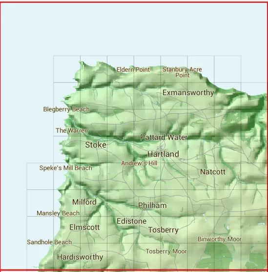
The SS22 10 square kilometre grid intersects with the settlements of Hartland & Philham.
SS22
SS22 is within the post town of Bideford, Devon.
The square is within Torridge District council.
The SS22 national grid square measures 10 km by 10 km and has an area of 1,000 kilometres squared.
The technical term for a 10 km map square is a Hectad.
When this 10 km square is divided into a grid 10 by 10 it gives the next size of grid square. This unit is called a Monad and measures 1km square. 100 monads fit in a 10km square.
Out of the monads generated from square SS22, 1093 are land and -993 are sea. Sea squares are disregarded on this site as they contain no land features.
 |
|
|
|
|
|
|
 |  |  |  |  |  |  | |||
 |  |  |  |  |  |  |  | ||
 |  |  |  |  |  |  |  | ||
 |  |  |  |  |  |  |  | ||
 |  |  |  |  |  |  |  |  | |
 |  |  |  |  |  |  |  |  | |
 |  |  |  |  |  |  |  |  | |
 |  |  |  |  |  |  |  |  |
| Corner | Latitude | Longitude | Easting | Northing |
|---|---|---|---|---|
| South West Corner | 50.951251 | -4.568993 | 220000 | 120000 |
| South East Corner | 50.951251 | -4.421804 | 230000 | 120000 |
| North West Corner | 51.044131 | -4.568993 | 220000 | 130000 |
| North East Corner | 51.044131 | -4.421804 | 230000 | 130000 |
1 KM Squares within the SS22 10 KM Square
SS2120 SS2121 SS2122 SS2123 SS2220 SS2221 SS2222 SS2223 SS2224 SS2225 SS2226 SS2227 SS2320 SS2321 SS2322 SS2323 SS2324 SS2325 SS2326 SS2327 SS2420 SS2421
SS2422 SS2423 SS2424 SS2425 SS2426 SS2427 SS2520 SS2521 SS2522 SS2523 SS2524 SS2525 SS2526 SS2527 SS2620 SS2621 SS2622 SS2623 SS2624 SS2625 SS2626 SS2627