Search for Grid Square by Postcode
SN77
Based in the Mid and West Wales region of Scotland.
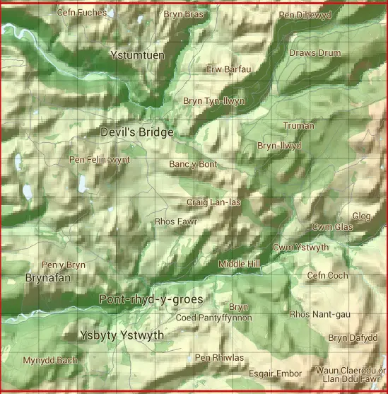
The SN77 10 square kilometre grid intersects with the settlements of Pont-rhyd-y-groes,Pontarfynach & Ysbyty Ystwyth.
SN77
SN77 is within the post towns of Aberystwyth, Cardiganshire & Ystrad Meurig, Cardiganshire.
The square is within Sir Ceredigion - Ceredigion council.
The SN77 national grid square measures 10 km by 10 km and has an area of 1,000 kilometres squared.
The technical term for a 10 km map square is a Hectad.
When this 10 km square is divided into a grid 10 by 10 it gives the next size of grid square. This unit is called a Monad and measures 1km square. 100 monads fit in a 10km square.
Out of the monads generated from square SN77, 1141 are land and -1041 are sea. Sea squares are disregarded on this site as they contain no land features.
|
|
|
|
|
|
 |
|
|
|
|
|
 |  |  |  |  |  |  |  |  |  |
 |  |  |  |  |  |  |  |  |  |
 |  |  |  |  |  |  |  |  |  |
 |  |  |  |  |  |  |  |  |  |
 |  |  |  |  |  |  |  |  |  |
 |  |  |  |  |  |  |  |  |  |
 |  |  |  |  |  |  |  |  |  |
 |  |  |  |  |  |  |  |  |  |
 |  |  |  |  |  |  |  |  |  |
 |  |  |  |  |  |  |  |  |  |
| Corner | Latitude | Longitude | Easting | Northing |
|---|---|---|---|---|
| South West Corner | 52.312685 | -3.912305 | 270000 | 270000 |
| South East Corner | 52.312685 | -3.761814 | 280000 | 270000 |
| North West Corner | 52.404823 | -3.912305 | 270000 | 280000 |
| North East Corner | 52.404823 | -3.761814 | 280000 | 280000 |