Search for Grid Square by Postcode
SN76
Based in the Mid and West Wales region of Scotland.
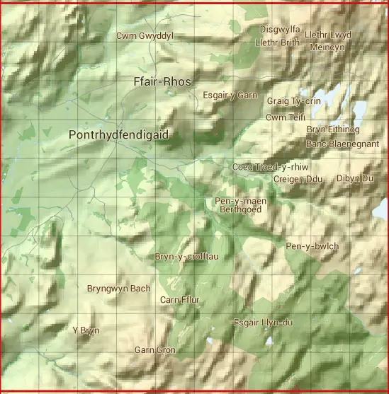
The SN76 10 square kilometre grid intersects with the settlements of Ffair-Rhos & Pontrhydfendigaid.
SN76
SN76 is within the post town of Ystrad Meurig, Cardiganshire.
The square is within Sir Ceredigion - Ceredigion council.
The SN76 national grid square measures 10 km by 10 km and has an area of 1,000 kilometres squared.
The technical term for a 10 km map square is a Hectad.
When this 10 km square is divided into a grid 10 by 10 it gives the next size of grid square. This unit is called a Monad and measures 1km square. 100 monads fit in a 10km square.
Out of the monads generated from square SN76, 363 are land and -263 are sea. Sea squares are disregarded on this site as they contain no land features.
|
|
|
|
|
|
 |
|
|
|
|
|
 |  |  |  |  |  |  |  |  |  |
 |  |  |  |  |  |  |  |  |  |
 |  |  |  |  |  |  |  |  |  |
 |  |  |  |  |  |  |  |  |  |
 |  |  |  |  |  |  |  |  |  |
 |  |  |  |  |  |  |  |  |  |
 |  |  |  |  |  |  |  |  |  |
 |  |  |  |  |  |  |  |  |  |
 |  |  |  |  |  |  |  |  |  |
 |  |  |  |  |  |  |  |  |  |
| Corner | Latitude | Longitude | Easting | Northing |
|---|---|---|---|---|
| South West Corner | 52.222831 | -3.908429 | 270000 | 260000 |
| South East Corner | 52.222831 | -3.758254 | 280000 | 260000 |
| North West Corner | 52.314963 | -3.908429 | 270000 | 270000 |
| North East Corner | 52.314963 | -3.758254 | 280000 | 270000 |