Search for Grid Square by Postcode
NO40
Based in the Mid Scotland and Fife region of Scotland.
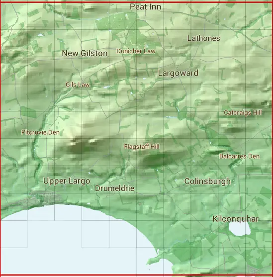
The NO40 10 square kilometre grid intersects with the settlements of Barnyards,Colinsburgh,Earlsferry,Elie,Kilconquhar,Largoward,Lower Largo,New Gilston,Peat Inn & Upper Largo.
NO40
NO40 is within the post towns of Anstruther, Fife, Cupar, Fife, Leven, Fife & St. Andrews, Fife.
The square is within Fife council.
The NO40 national grid square measures 10 km by 10 km and has an area of 1,000 kilometres squared.
The technical term for a 10 km map square is a Hectad.
When this 10 km square is divided into a grid 10 by 10 it gives the next size of grid square. This unit is called a Monad and measures 1km square. 100 monads fit in a 10km square.
Out of the monads generated from square NO40, 383 are land and -283 are sea. Sea squares are disregarded on this site as they contain no land features.
|
|
|
|
|
|
 |
|
|
|
|
|
 |  |  |  |  |  |  |  |  |  |
 |  |  |  |  |  |  |  |  |  |
 |  |  |  |  |  |  |  |  |  |
 |  |  |  |  |  |  |  |  |  |
 |  |  |  |  |  |  |  |  |  |
 |  |  |  |  |  |  |  |  |  |
 |  |  |  |  |  |  |  |  |  |
 |  |  |  |  |  |  |  |  |  |
 |  |  |  |  |  |  |  | ||
 |  |  |  |  |
| Corner | Latitude | Longitude | Easting | Northing |
|---|---|---|---|---|
| South West Corner | 56.188819 | -2.970602 | 340000 | 700000 |
| South East Corner | 56.188819 | -2.807230 | 350000 | 700000 |
| North West Corner | 56.279809 | -2.970602 | 340000 | 710000 |
| North East Corner | 56.279809 | -2.807230 | 350000 | 710000 |