Search for Grid Square by Postcode
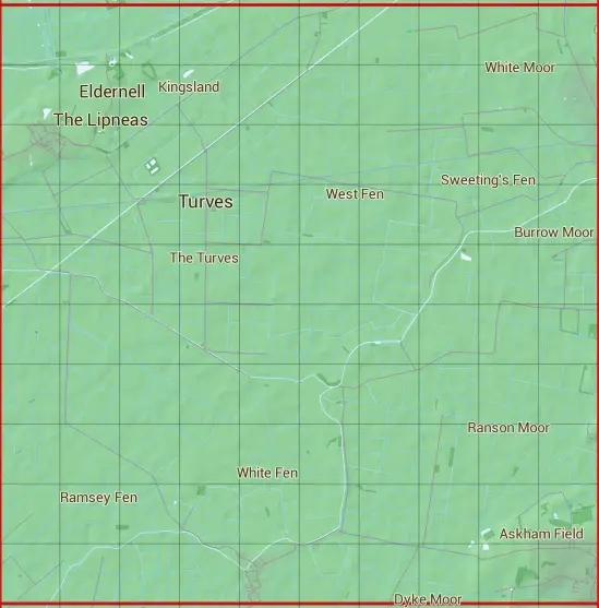
TL39
Based in the Eastern English Region.
The TL39 10 square kilometre grid intersects with the settlements of Benwick,Coates,Doddington,Turves & Westry.
TL39
TL39 is within the post towns of Huntingdon, Huntingdonshire, March, Cambridgeshire, Peterborough, Northamptonshire & Wisbech, Cambridgeshire.
The square is within Fenland District & Huntingdonshire District councils.
The TL39 national grid square measures 10 km by 10 km and has an area of 1,000 kilometres squared.
The technical term for a 10 km map square is a Hectad.
When this 10 km square is divided into a grid 10 by 10 it gives the next size of grid square. This unit is called a Monad and measures 1km square. 100 monads fit in a 10km square.
Out of the monads generated from square TL39, 523 are land and -423 are sea. Sea squares are disregarded on this site as they contain no land features.
|
|
|
|
|
|
 |
|
|
|
|
|
 |  |  |  |  |  |  |  |  |  |
 |  |  |  |  |  |  |  |  |  |
 |  |  |  |  |  |  |  |  |  |
 |  |  |  |  |  |  |  |  |  |
 |  |  |  |  |  |  |  |  |  |
 |  |  |  |  |  |  |  |  |  |
 |  |  |  |  |  |  |  |  |  |
 |  |  |  |  |  |  |  |  |  |
 |  |  |  |  |  |  |  |  |  |
 |  |  |  |  |  |  |  |  |  |
| Corner | Latitude | Longitude | Easting | Northing |
|---|---|---|---|---|
| South West Corner | 52.489973 | -0.086645 | 530000 | 290000 |
| South East Corner | 52.489973 | 0.064754 | 540000 | 290000 |
| North West Corner | 52.582295 | -0.086645 | 530000 | 300000 |
| North East Corner | 52.582295 | 0.064754 | 540000 | 300000 |