Search for Grid Square by Postcode
TL36
Based in the Eastern English Region.
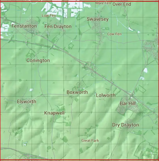
The TL36 10 square kilometre grid intersects with the settlements of Bar Hill,Boxworth,Cambourne,Conington,Dry Drayton,Elsworth,Fen Drayton,Fenstanton,Hemingford Grey,Knapwell,Lolworth,Longstanton,Madingley,Northstowe,Over,Swavesey & Willingham.
TL36
TL36 is within the post towns of Cambridge, Cambridgeshire, Huntingdon, Huntingdonshire & St. Ives, Huntingdonshire.
The square is within Huntingdonshire District & South Cambridgeshire District councils.
The TL36 national grid square measures 10 km by 10 km and has an area of 1,000 kilometres squared.
The technical term for a 10 km map square is a Hectad.
When this 10 km square is divided into a grid 10 by 10 it gives the next size of grid square. This unit is called a Monad and measures 1km square. 100 monads fit in a 10km square.
Out of the monads generated from square TL36, 523 are land and -423 are sea. Sea squares are disregarded on this site as they contain no land features.
|
|
|
|
|
|
 |
|
|
|
|
|
 |  |  |  |  |  |  |  |  |  |
 |  |  |  |  |  |  |  |  |  |
 |  |  |  |  |  |  |  |  |  |
 |  |  |  |  |  |  |  |  |  |
 |  |  |  |  |  |  |  |  |  |
 |  |  |  |  |  |  |  |  |  |
 |  |  |  |  |  |  |  |  |  |
 |  |  |  |  |  |  |  |  |  |
 |  |  |  |  |  |  |  |  |  |
 |  |  |  |  |  |  |  |  |  |
| Corner | Latitude | Longitude | Easting | Northing |
|---|---|---|---|---|
| South West Corner | 52.220438 | -0.098250 | 530000 | 260000 |
| South East Corner | 52.220438 | 0.052195 | 540000 | 260000 |
| North West Corner | 52.312741 | -0.098250 | 530000 | 270000 |
| North East Corner | 52.312741 | 0.052195 | 540000 | 270000 |