Search for Grid Square by Postcode
TL07
Based in the East Midlands English Region & Eastern English Region.
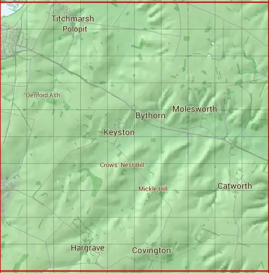
The TL07 10 square kilometre grid intersects with the settlements of Brington,Bythorn,Catworth,Covington,Hargrave,Keyston,Molesworth,Old Weston,Raunds,Thrapston & Titchmarsh.
TL07
TL07 is within the post towns of Huntingdon, Huntingdonshire, Kettering, Northamptonshire & Wellingborough, Northamptonshire.
The square is within Bedford, Huntingdonshire District & North Northamptonshire councils.
The TL07 national grid square measures 10 km by 10 km and has an area of 1,000 kilometres squared.
The technical term for a 10 km map square is a Hectad.
When this 10 km square is divided into a grid 10 by 10 it gives the next size of grid square. This unit is called a Monad and measures 1km square. 100 monads fit in a 10km square.
Out of the monads generated from square TL07, 523 are land and -423 are sea. Sea squares are disregarded on this site as they contain no land features.
|
|
|
|
|
|
 |
|
|
|
|
|
 |  |  |  |  |  |  |  |  |  |
 |  |  |  |  |  |  |  |  |  |
 |  |  |  |  |  |  |  |  |  |
 |  |  |  |  |  |  |  |  |  |
 |  |  |  |  |  |  |  |  |  |
 |  |  |  |  |  |  |  |  |  |
 |  |  |  |  |  |  |  |  |  |
 |  |  |  |  |  |  |  |  |  |
 |  |  |  |  |  |  |  |  |  |
 |  |  |  |  |  |  |  |  |  |
| Corner | Latitude | Longitude | Easting | Northing |
|---|---|---|---|---|
| South West Corner | 52.317107 | -0.534305 | 500000 | 270000 |
| South East Corner | 52.317107 | -0.384379 | 510000 | 270000 |
| North West Corner | 52.408891 | -0.534305 | 500000 | 280000 |
| North East Corner | 52.408891 | -0.384379 | 510000 | 280000 |