Search for Grid Square by Postcode
SX69
Based in the South West English Region.
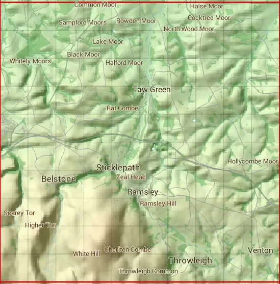
The SX69 10 square kilometre grid intersects with the settlements of Belstone Corner,Itton,Okehampton,South Tawton,South Zeal,Spreyton,Sticklepath,Throwleigh & Whiddon Down.
SX69
SX69 is within the post towns of Crediton, Devon, Exeter, Devon, Newton Abbot, Devon & Okehampton, Devon.
The square is within Mid Devon District & West Devon District councils.
The SX69 national grid square measures 10 km by 10 km and has an area of 1,000 kilometres squared.
The technical term for a 10 km map square is a Hectad.
When this 10 km square is divided into a grid 10 by 10 it gives the next size of grid square. This unit is called a Monad and measures 1km square. 100 monads fit in a 10km square.
Out of the monads generated from square SX69, 420 are land and -320 are sea. Sea squares are disregarded on this site as they contain no land features.
|
|
|
|
|
|
 |
|
|
|
|
|
 |  |  |  |  |  |  |  |  |  |
 |  |  |  |  |  |  |  |  |  |
 |  |  |  |  |  |  |  |  |  |
 |  |  |  |  |  |  |  |  |  |
 |  |  |  |  |  |  |  |  |  |
 |  |  |  |  |  |  |  |  |  |
 |  |  |  |  |  |  |  |  |  |
 |  |  |  |  |  |  |  |  |  |
 |  |  |  |  |  |  |  |  |  |
 |  |  |  |  |  |  |  |  |  |
| Corner | Latitude | Longitude | Easting | Northing |
|---|---|---|---|---|
| South West Corner | 50.692746 | -3.987311 | 260000 | 90000 |
| South East Corner | 50.692746 | -3.842007 | 270000 | 90000 |
| North West Corner | 50.784948 | -3.987311 | 260000 | 100000 |
| North East Corner | 50.784948 | -3.842007 | 270000 | 100000 |