Search for Grid Square by Postcode
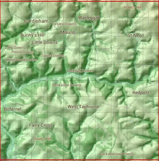
SX16
Based in the South West English Region.
The SX16 10 square kilometre grid intersects with the settlements of Cardinham,Doublebois,East Taphouse,Lostwithiel,Mount & St Neot.
SX16
SX16 is within the post towns of Bodmin, Cornwall, Liskeard, Cornwall & Lostwithiel, Cornwall.
The square is within Cornwall council.
The SX16 national grid square measures 10 km by 10 km and has an area of 1,000 kilometres squared.
The technical term for a 10 km map square is a Hectad.
When this 10 km square is divided into a grid 10 by 10 it gives the next size of grid square. This unit is called a Monad and measures 1km square. 100 monads fit in a 10km square.
Out of the monads generated from square SX16, 346 are land and -246 are sea. Sea squares are disregarded on this site as they contain no land features.
|
|
|
|
|
|
 |
|
|
|
|
|
 |  |  |  |  |  |  |  |  |  |
 |  |  |  |  |  |  |  |  |  |
 |  |  |  |  |  |  |  |  |  |
 |  |  |  |  |  |  |  |  |  |
 |  |  |  |  |  |  |  |  |  |
 |  |  |  |  |  |  |  |  |  |
 |  |  |  |  |  |  |  |  |  |
 |  |  |  |  |  |  |  |  |  |
 |  |  |  |  |  |  |  |  |  |
 |  |  |  |  |  |  |  |  |  |
| Corner | Latitude | Longitude | Easting | Northing |
|---|---|---|---|---|
| South West Corner | 50.409062 | -4.680476 | 210000 | 60000 |
| South East Corner | 50.409062 | -4.534813 | 220000 | 60000 |
| North West Corner | 50.502056 | -4.680476 | 210000 | 70000 |
| North East Corner | 50.502056 | -4.534813 | 220000 | 70000 |