Search for Grid Square by Postcode
ST57
Based in the South West English Region.
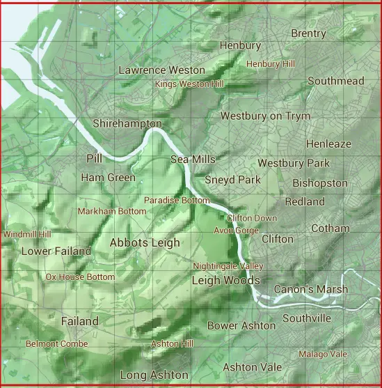
The ST57 10 square kilometre grid intersects with the settlements of Abbots Leigh,Avonmouth,Bristol,Easton-in-Gordano,Failand,Filton,Hallen,Leigh Woods,Long Ashton,Lower Failand,Pill,Portbury & Portbury Docks.
ST57
ST57 is within the post town of Bristol, Gloucestershire.
The square is within City of Bristol, North Somerset & South Gloucestershire councils.
The ST57 national grid square measures 10 km by 10 km and has an area of 1,000 kilometres squared.
The technical term for a 10 km map square is a Hectad.
When this 10 km square is divided into a grid 10 by 10 it gives the next size of grid square. This unit is called a Monad and measures 1km square. 100 monads fit in a 10km square.
Out of the monads generated from square ST57, 455 are land and -355 are sea. Sea squares are disregarded on this site as they contain no land features.
|
|
|
|
|
|
 |
|
|
|
|
|
 |  |  |  |  |  |  |  |  |  |
 |  |  |  |  |  |  |  |  |  |
 |  |  |  |  |  |  |  |  |  |
 |  |  |  |  |  |  |  |  |  |
 |  |  |  |  |  |  |  |  |  |
 |  |  |  |  |  |  |  |  |  |
 |  |  |  |  |  |  |  |  |  |
 |  |  |  |  |  |  |  |  |  |
 |  |  |  |  |  |  |  |  |  |
 |  |  |  |  |  |  |  |  |  |
| Corner | Latitude | Longitude | Easting | Northing |
|---|---|---|---|---|
| South West Corner | 51.426787 | -2.721973 | 350000 | 170000 |
| South East Corner | 51.426787 | -2.576727 | 360000 | 170000 |
| North West Corner | 51.517494 | -2.721973 | 350000 | 180000 |
| North East Corner | 51.517494 | -2.576727 | 360000 | 180000 |