Search for Grid Square by Postcode
ST25
Based in the South West English Region.
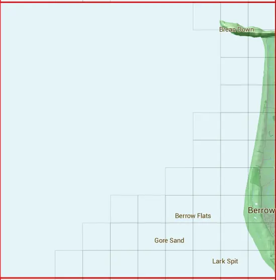
The ST25 10 square kilometre grid intersects with the settlements of Berrow,Brean & Burnham-on-Sea.
ST25
ST25 is within the post town of Burnham-on-sea, Somerset.
The square is within North Somerset & Sedgemoor District councils.
The ST25 national grid square measures 10 km by 10 km and has an area of 1,000 kilometres squared.
The technical term for a 10 km map square is a Hectad.
When this 10 km square is divided into a grid 10 by 10 it gives the next size of grid square. This unit is called a Monad and measures 1km square. 100 monads fit in a 10km square.
Out of the monads generated from square ST25, 405 are land and -305 are sea. Sea squares are disregarded on this site as they contain no land features.
|
|
|
|
 |
|
|
|
|
|
|
 |  |  | |||||||
 |  | ||||||||
 |  | ||||||||
 |  | ||||||||
 |  |  | |||||||
 |  |  | |||||||
 |  |  |  | ||||||
 |  |  |  |  |  | ||||
 |  |  |  |  |  |  | |||
 |  |  |  |  |  |  |  |
| Corner | Latitude | Longitude | Easting | Northing |
|---|---|---|---|---|
| South West Corner | 51.243541 | -3.149724 | 320000 | 150000 |
| South East Corner | 51.243541 | -3.004244 | 330000 | 150000 |
| North West Corner | 51.334761 | -3.149724 | 320000 | 160000 |
| North East Corner | 51.334761 | -3.004244 | 330000 | 160000 |