Search for Grid Square by Postcode
SS80
Based in the South West English Region.
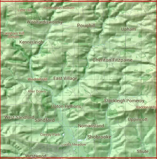
The SS80 10 square kilometre grid intersects with the settlements of Black Dog,Cheriton Fitzpaine,Crediton,Efford,Kennerleigh,Poughill,Sandford,Shobrooke,Shute,Upham,Uppincott & West Sandford.
SS80
SS80 is within the post towns of Crediton, Devon, Exeter, Devon & Tiverton, Devon.
The square is within East Devon District & Mid Devon District councils.
The SS80 national grid square measures 10 km by 10 km and has an area of 1,000 kilometres squared.
The technical term for a 10 km map square is a Hectad.
When this 10 km square is divided into a grid 10 by 10 it gives the next size of grid square. This unit is called a Monad and measures 1km square. 100 monads fit in a 10km square.
Out of the monads generated from square SS80, 338 are land and -238 are sea. Sea squares are disregarded on this site as they contain no land features.
|
|
|
|
|
|
 |
|
|
|
|
|
 |  |  |  |  |  |  |  |  |  |
 |  |  |  |  |  |  |  |  |  |
 |  |  |  |  |  |  |  |  |  |
 |  |  |  |  |  |  |  |  |  |
 |  |  |  |  |  |  |  |  |  |
 |  |  |  |  |  |  |  |  |  |
 |  |  |  |  |  |  |  |  |  |
 |  |  |  |  |  |  |  |  |  |
 |  |  |  |  |  |  |  |  |  |
 |  |  |  |  |  |  |  |  |  |
| Corner | Latitude | Longitude | Easting | Northing |
|---|---|---|---|---|
| South West Corner | 50.787105 | -3.707026 | 280000 | 100000 |
| South East Corner | 50.787105 | -3.561942 | 290000 | 100000 |
| North West Corner | 50.878983 | -3.707026 | 280000 | 110000 |
| North East Corner | 50.878983 | -3.561942 | 290000 | 110000 |