Search for Grid Square by Postcode
TL05
Based in the Eastern English Region.
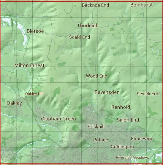
The TL05 10 square kilometre grid intersects with the settlements of Bedford,Bletsoe,Bolnhurst,Bromham,Clapham,Clapham Green,Cross End,Milton Ernest,Oakley,Radwell,Ravensden,Renhold,Rootham's Green,Salph End,Sevick End,Sharnbrook,Thurleigh,Wilden,Wood End & Workhouse End.
TL05
TL05 is within the post town of Bedford, Bedfordshire.
The square is within Bedford council.
The TL05 national grid square measures 10 km by 10 km and has an area of 1,000 kilometres squared.
The technical term for a 10 km map square is a Hectad.
When this 10 km square is divided into a grid 10 by 10 it gives the next size of grid square. This unit is called a Monad and measures 1km square. 100 monads fit in a 10km square.
Out of the monads generated from square TL05, 523 are land and -423 are sea. Sea squares are disregarded on this site as they contain no land features.
|
|
|
|
|
|
 |
|
|
|
|
|
 |  |  |  |  |  |  |  |  |  |
 |  |  |  |  |  |  |  |  |  |
 |  |  |  |  |  |  |  |  |  |
 |  |  |  |  |  |  |  |  |  |
 |  |  |  |  |  |  |  |  |  |
 |  |  |  |  |  |  |  |  |  |
 |  |  |  |  |  |  |  |  |  |
 |  |  |  |  |  |  |  |  |  |
 |  |  |  |  |  |  |  |  |  |
 |  |  |  |  |  |  |  |  |  |
| Corner | Latitude | Longitude | Easting | Northing |
|---|---|---|---|---|
| South West Corner | 52.137369 | -0.540209 | 500000 | 250000 |
| South East Corner | 52.137369 | -0.390909 | 510000 | 250000 |
| North West Corner | 52.229144 | -0.540209 | 500000 | 260000 |
| North East Corner | 52.229144 | -0.390909 | 510000 | 260000 |