Search for Grid Square by Postcode
SP11
Based in the South West English Region.
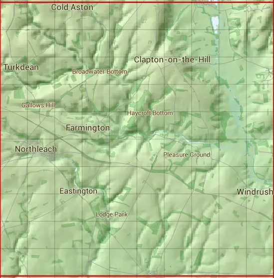
The SP11 10 square kilometre grid intersects with the settlements of Aldsworth,Bourton-on-the-Water,Cold Aston,Great Rissington,Little Rissington,Northleach,Sherborne,Turkdean & Windrush.
SP11
SP11 is within the post towns of Burford, Oxfordshire & Cheltenham, Gloucestershire.
The square is within Cotswold District council.
The SP11 national grid square measures 10 km by 10 km and has an area of 1,000 kilometres squared.
The technical term for a 10 km map square is a Hectad.
When this 10 km square is divided into a grid 10 by 10 it gives the next size of grid square. This unit is called a Monad and measures 1km square. 100 monads fit in a 10km square.
Out of the monads generated from square SP11, 1900 are land and -1800 are sea. Sea squares are disregarded on this site as they contain no land features.
|
|
|
|
|
|
 |
|
|
|
|
|
 |  |  |  |  |  |  |  |  |  |
 |  |  |  |  |  |  |  |  |  |
 |  |  |  |  |  |  |  |  |  |
 |  |  |  |  |  |  |  |  |  |
 |  |  |  |  |  |  |  |  |  |
 |  |  |  |  |  |  |  |  |  |
 |  |  |  |  |  |  |  |  |  |
 |  |  |  |  |  |  |  |  |  |
 |  |  |  |  |  |  |  |  |  |
 |  |  |  |  |  |  |  |  |  |
| Corner | Latitude | Longitude | Easting | Northing |
|---|---|---|---|---|
| South West Corner | 51.788309 | -1.856413 | 410000 | 210000 |
| South East Corner | 51.788309 | -1.710860 | 420000 | 210000 |
| North West Corner | 51.878487 | -1.856413 | 410000 | 220000 |
| North East Corner | 51.878487 | -1.710860 | 420000 | 220000 |