Search for Grid Square by Postcode
SM93
Based in the Mid and West Wales region of Scotland.
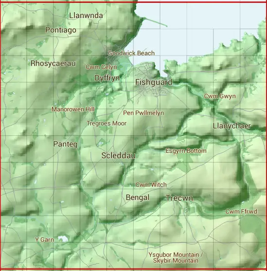
The SM93 10 square kilometre grid intersects with the settlements of Abergwaun,Casmorys,Dinas Cross,Letterston,Letterston / Treletert,Llanwnda,Llanychaer,Scleddau,Trecwn & Wdig.
SM93
SM93 is within the post towns of Fishguard, Pembrokeshire, Goodwick, Pembrokeshire, Haverfordwest, Pembrokeshire & Newport, Pembrokeshire.
The square is within Sir Benfro - Pembrokeshire council.
The SM93 national grid square measures 10 km by 10 km and has an area of 1,000 kilometres squared.
The technical term for a 10 km map square is a Hectad.
When this 10 km square is divided into a grid 10 by 10 it gives the next size of grid square. This unit is called a Monad and measures 1km square. 100 monads fit in a 10km square.
Out of the monads generated from square SM93, 147 are land and -47 are sea. Sea squares are disregarded on this site as they contain no land features.
|
|
|
|
|
|
 |
|
|
|
|
|
 |  |  |  |  |  |  |  | ||
 |  |  |  |  |  |  |  |  | |
 |  |  |  |  |  |  |  |  |  |
 |  |  |  |  |  |  |  |  |  |
 |  |  |  |  |  |  |  |  |  |
 |  |  |  |  |  |  |  |  |  |
 |  |  |  |  |  |  |  |  |  |
 |  |  |  |  |  |  |  |  |  |
 |  |  |  |  |  |  |  |  |  |
 |  |  |  |  |  |  |  |  |  |
| Corner | Latitude | Longitude | Easting | Northing |
|---|---|---|---|---|
| South West Corner | 51.928811 | -5.061940 | 190000 | 230000 |
| South East Corner | 51.928811 | -4.910581 | 200000 | 230000 |
| North West Corner | 52.022287 | -5.061940 | 190000 | 240000 |
| North East Corner | 52.022287 | -4.910581 | 200000 | 240000 |