Search for Grid Square by Postcode
SE35
Based in the Yorkshire and the Humber English Region.
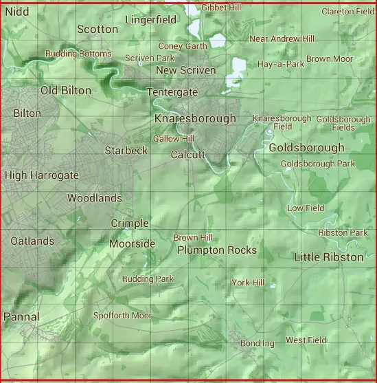
The SE35 10 square kilometre grid intersects with the settlements of Coneythorpe,Flaxby,Follifoot,Forest Moor,Goldsborough,Harrogate,Kirk Deighton,Knaresborough,Lingerfield,Little Ribston,Nidd,North Deighton,Old Bilton,Pannal,Scotton,Spofforth & Thistle Hill.
SE35
SE35 is within the post towns of Harrogate, Yorkshire, Knaresborough, Yorkshire, Leeds, Yorkshire & Wetherby, Yorkshire.
The square is within Harrogate District council.
The SE35 national grid square measures 10 km by 10 km and has an area of 1,000 kilometres squared.
The technical term for a 10 km map square is a Hectad.
When this 10 km square is divided into a grid 10 by 10 it gives the next size of grid square. This unit is called a Monad and measures 1km square. 100 monads fit in a 10km square.
Out of the monads generated from square SE35, 523 are land and -423 are sea. Sea squares are disregarded on this site as they contain no land features.
|
|
|
|
|
|
 |
|
|
|
|
|
 |  |  |  |  |  |  |  |  |  |
 |  |  |  |  |  |  |  |  |  |
 |  |  |  |  |  |  |  |  |  |
 |  |  |  |  |  |  |  |  |  |
 |  |  |  |  |  |  |  |  |  |
 |  |  |  |  |  |  |  |  |  |
 |  |  |  |  |  |  |  |  |  |
 |  |  |  |  |  |  |  |  |  |
 |  |  |  |  |  |  |  |  |  |
 |  |  |  |  |  |  |  |  |  |
| Corner | Latitude | Longitude | Easting | Northing |
|---|---|---|---|---|
| South West Corner | 53.944585 | -1.544436 | 430000 | 450000 |
| South East Corner | 53.944585 | -1.390782 | 440000 | 450000 |
| North West Corner | 54.035131 | -1.544436 | 430000 | 460000 |
| North East Corner | 54.035131 | -1.390782 | 440000 | 460000 |