Search for Grid Square by Postcode
NZ41
Based in the North East English Region & Yorkshire and the Humber English Region.
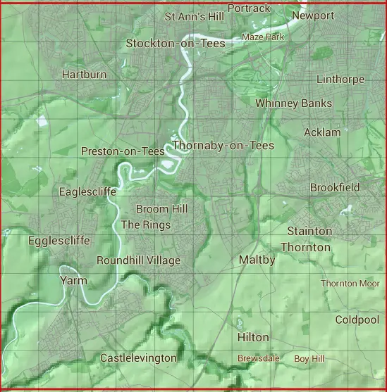
The NZ41 10 square kilometre grid intersects with the settlements of Aislaby,Egglescliffe,Elton,Hilton,Ingleby Barwick,Kirklevington,Maltby,Middlesbrough,Preston-on-Tees,Seamer,Stainton,Stockton-on-Tees,Thornaby-on-Tees,Thornton & Yarm.
NZ41
NZ41 is within the post towns of Middlesbrough, Yorkshire, Stockton-on-tees, County Durham & Yarm, Yorkshire.
The square is within Hambleton District, Middlesbrough & Stockton-on-Tees councils.
The NZ41 national grid square measures 10 km by 10 km and has an area of 1,000 kilometres squared.
The technical term for a 10 km map square is a Hectad.
When this 10 km square is divided into a grid 10 by 10 it gives the next size of grid square. This unit is called a Monad and measures 1km square. 100 monads fit in a 10km square.
Out of the monads generated from square NZ41, 363 are land and -263 are sea. Sea squares are disregarded on this site as they contain no land features.
|
|
|
|
|
|
 |
|
|
|
|
|
 |  |  |  |  |  |  |  |  |  |
 |  |  |  |  |  |  |  |  |  |
 |  |  |  |  |  |  |  |  |  |
 |  |  |  |  |  |  |  |  |  |
 |  |  |  |  |  |  |  |  |  |
 |  |  |  |  |  |  |  |  |  |
 |  |  |  |  |  |  |  |  |  |
 |  |  |  |  |  |  |  |  |  |
 |  |  |  |  |  |  |  |  |  |
 |  |  |  |  |  |  |  |  |  |
| Corner | Latitude | Longitude | Easting | Northing |
|---|---|---|---|---|
| South West Corner | 54.482906 | -1.384130 | 440000 | 510000 |
| South East Corner | 54.482906 | -1.228106 | 450000 | 510000 |
| North West Corner | 54.573653 | -1.384130 | 440000 | 520000 |
| North East Corner | 54.573653 | -1.228106 | 450000 | 520000 |