Search for Grid Square by Postcode
NZ10
Based in the North East English Region & Yorkshire and the Humber English Region.
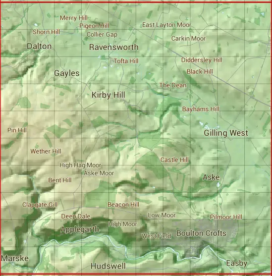
The NZ10 10 square kilometre grid intersects with the settlements of Aske,Dalton,Easby,East Layton,Gayles,Gilling West,Hartforth,Hudswell,Kirby Hill,Marske,Melsonby,Newsham,Ravensworth,Richmond,Skeeby & Whashton.
NZ10
NZ10 is within the post towns of Catterick Garrison, Yorkshire & Richmond, Yorkshire.
The square is within County Durham & Richmondshire District councils.
The NZ10 national grid square measures 10 km by 10 km and has an area of 1,000 kilometres squared.
The technical term for a 10 km map square is a Hectad.
When this 10 km square is divided into a grid 10 by 10 it gives the next size of grid square. This unit is called a Monad and measures 1km square. 100 monads fit in a 10km square.
Out of the monads generated from square NZ10, 477 are land and -377 are sea. Sea squares are disregarded on this site as they contain no land features.
|
|
|
|
|
|
 |
|
|
|
|
|
 |  |  |  |  |  |  |  |  |  |
 |  |  |  |  |  |  |  |  |  |
 |  |  |  |  |  |  |  |  |  |
 |  |  |  |  |  |  |  |  |  |
 |  |  |  |  |  |  |  |  |  |
 |  |  |  |  |  |  |  |  |  |
 |  |  |  |  |  |  |  |  |  |
 |  |  |  |  |  |  |  |  |  |
 |  |  |  |  |  |  |  |  |  |
 |  |  |  |  |  |  |  |  |  |
| Corner | Latitude | Longitude | Easting | Northing |
|---|---|---|---|---|
| South West Corner | 54.395097 | -1.847498 | 410000 | 500000 |
| South East Corner | 54.395097 | -1.692816 | 420000 | 500000 |
| North West Corner | 54.485258 | -1.847498 | 410000 | 510000 |
| North East Corner | 54.485258 | -1.692816 | 420000 | 510000 |