Search for Grid Square by Postcode
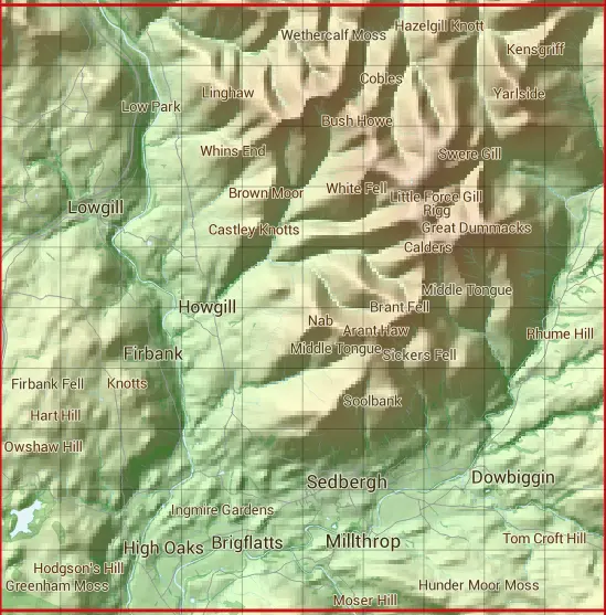
SD69
Based in the North West English Region.
The SD69 10 square kilometre grid intersects with the settlements of Brigflatts,Cautley,Dowbiggin,Howgill,Marthwaite,Millthrop & Sedbergh.
SD69
SD69 is within the post towns of Carnforth, Lancashire, Kendal, Westmorland, Kirkby Stephen, Westmorland, Penrith, Cumberland & Sedbergh, Yorkshire.
The square is within Eden District & South Lakeland District councils.
The SD69 national grid square measures 10 km by 10 km and has an area of 1,000 kilometres squared.
The technical term for a 10 km map square is a Hectad.
When this 10 km square is divided into a grid 10 by 10 it gives the next size of grid square. This unit is called a Monad and measures 1km square. 100 monads fit in a 10km square.
Out of the monads generated from square SD69, 492 are land and -392 are sea. Sea squares are disregarded on this site as they contain no land features.
|
|
|
|
|
|
 |
|
|
|
|
|
 |  |  |  |  |  |  |  |  |  |
 |  |  |  |  |  |  |  |  |  |
 |  |  |  |  |  |  |  |  |  |
 |  |  |  |  |  |  |  |  |  |
 |  |  |  |  |  |  |  |  |  |
 |  |  |  |  |  |  |  |  |  |
 |  |  |  |  |  |  |  |  |  |
 |  |  |  |  |  |  |  |  |  |
 |  |  |  |  |  |  |  |  |  |
 |  |  |  |  |  |  |  |  |  |
| Corner | Latitude | Longitude | Easting | Northing |
|---|---|---|---|---|
| South West Corner | 54.304038 | -2.617551 | 360000 | 490000 |
| South East Corner | 54.304038 | -2.462537 | 370000 | 490000 |
| North West Corner | 54.394594 | -2.617551 | 360000 | 500000 |
| North East Corner | 54.394594 | -2.462537 | 370000 | 500000 |