Search for Grid Square by Postcode
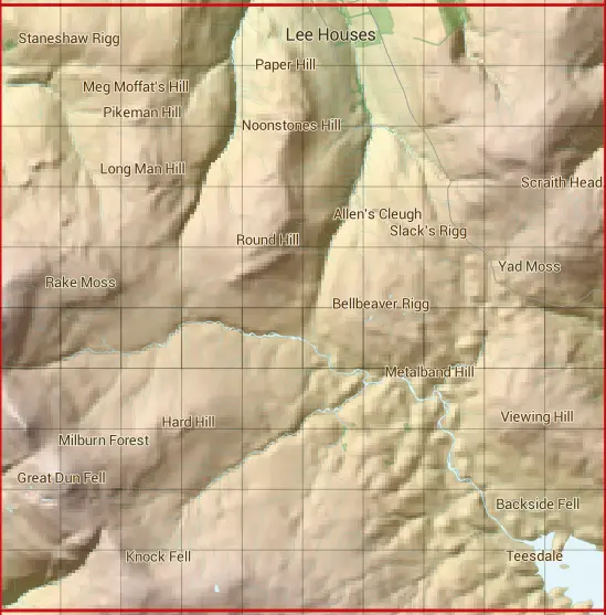
NY73
Based in the North East English Region & North West English Region.
NY73
NY73 is within the post towns of Alston, Cumberland, Appleby-in-westmorland, Westmorland, Barnard Castle, County Durham, Bishop Auckland, County Durham & Penrith, Cumberland.
The square is within County Durham & Eden District councils.
The NY73 national grid square measures 10 km by 10 km and has an area of 1,000 kilometres squared.
The technical term for a 10 km map square is a Hectad.
When this 10 km square is divided into a grid 10 by 10 it gives the next size of grid square. This unit is called a Monad and measures 1km square. 100 monads fit in a 10km square.
Out of the monads generated from square NY73, 539 are land and -439 are sea. Sea squares are disregarded on this site as they contain no land features.
|
|
|
|
|
|
 |
|
|
|
|
|
 |  |  |  |  |  |  |  |  |  |
 |  |  |  |  |  |  |  |  |  |
 |  |  |  |  |  |  |  |  |  |
 |  |  |  |  |  |  |  |  |  |
 |  |  |  |  |  |  |  |  |  |
 |  |  |  |  |  |  |  |  |  |
 |  |  |  |  |  |  |  |  |  |
 |  |  |  |  |  |  |  |  |  |
 |  |  |  |  |  |  |  |  |  |
 |  |  |  |  |  |  |  |  |  |
| Corner | Latitude | Longitude | Easting | Northing |
|---|---|---|---|---|
| South West Corner | 54.664189 | -2.467650 | 370000 | 530000 |
| South East Corner | 54.664189 | -2.311589 | 380000 | 530000 |
| North West Corner | 54.754551 | -2.467650 | 370000 | 540000 |
| North East Corner | 54.754551 | -2.311589 | 380000 | 540000 |