Search for Grid Square by Postcode
NS31
Based in the South Scotland region of Scotland.
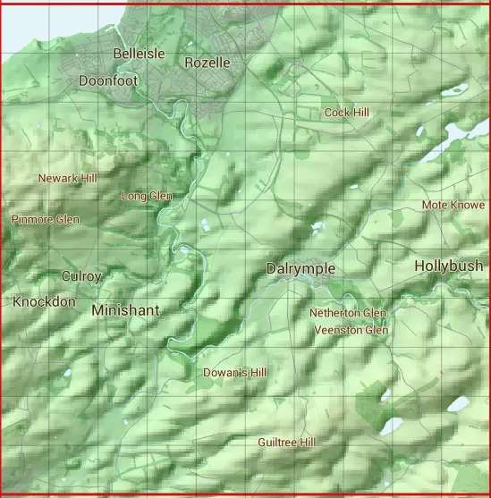
The NS31 10 square kilometre grid intersects with the settlements of Ayr,Dalrymple,Hollybush,Maybole & Minishant.
NS31
NS31 is within the post towns of Ayr, Ayrshire & Maybole, Ayrshire.
The square is within East Ayrshire & South Ayrshire councils.
The NS31 national grid square measures 10 km by 10 km and has an area of 1,000 kilometres squared.
The technical term for a 10 km map square is a Hectad.
When this 10 km square is divided into a grid 10 by 10 it gives the next size of grid square. This unit is called a Monad and measures 1km square. 100 monads fit in a 10km square.
Out of the monads generated from square NS31, 440 are land and -340 are sea. Sea squares are disregarded on this site as they contain no land features.
|
|
|
|
|
|
 |
|
|
|
|
|
 |  |  |  |  |  |  |  |  |  |
 |  |  |  |  |  |  |  |  |  |
 |  |  |  |  |  |  |  |  |  |
 |  |  |  |  |  |  |  |  |  |
 |  |  |  |  |  |  |  |  |  |
 |  |  |  |  |  |  |  |  |  |
 |  |  |  |  |  |  |  |  |  |
 |  |  |  |  |  |  |  |  |  |
 |  |  |  |  |  |  |  |  |  |
 |  |  |  |  |  |  |  |  |  |
| Corner | Latitude | Longitude | Easting | Northing |
|---|---|---|---|---|
| South West Corner | 55.354518 | -4.689134 | 230000 | 610000 |
| South East Corner | 55.354518 | -4.525487 | 240000 | 610000 |
| North West Corner | 55.447643 | -4.689134 | 230000 | 620000 |
| North East Corner | 55.447643 | -4.525487 | 240000 | 620000 |