Search for Grid Square by Postcode
NN60
Based in the Mid Scotland and Fife region of Scotland.
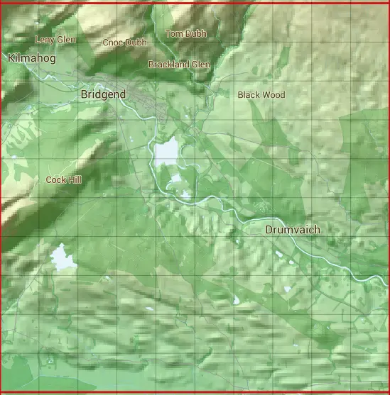
The NN60 10 square kilometre grid intersects with the settlements of Callander & Thornhill.
NN60
NN60 is within the post towns of Callander, Perthshire, Doune, Perthshire & Stirling, Stirlingshire.
The square is within Stirling council.
The NN60 national grid square measures 10 km by 10 km and has an area of 1,000 kilometres squared.
The technical term for a 10 km map square is a Hectad.
When this 10 km square is divided into a grid 10 by 10 it gives the next size of grid square. This unit is called a Monad and measures 1km square. 100 monads fit in a 10km square.
Out of the monads generated from square NN60, 518 are land and -418 are sea. Sea squares are disregarded on this site as they contain no land features.
|
|
|
|
|
|
 |
|
|
|
|
|
 |  |  |  |  |  |  |  |  |  |
 |  |  |  |  |  |  |  |  |  |
 |  |  |  |  |  |  |  |  |  |
 |  |  |  |  |  |  |  |  |  |
 |  |  |  |  |  |  |  |  |  |
 |  |  |  |  |  |  |  |  |  |
 |  |  |  |  |  |  |  |  |  |
 |  |  |  |  |  |  |  |  |  |
 |  |  |  |  |  |  |  |  |  |
 |  |  |  |  |  |  |  |  |  |
| Corner | Latitude | Longitude | Easting | Northing |
|---|---|---|---|---|
| South West Corner | 56.172012 | -4.261787 | 260000 | 700000 |
| South East Corner | 56.172012 | -4.095565 | 270000 | 700000 |
| North West Corner | 56.264629 | -4.261787 | 260000 | 710000 |
| North East Corner | 56.264629 | -4.095565 | 270000 | 710000 |