Search for Grid Square by Postcode
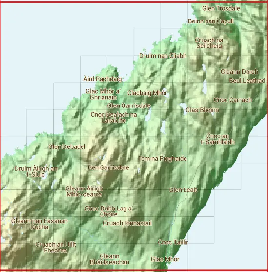
NR69
Based in the Highlands and Islands region of Scotland.
NR69
NR69 is within the post town of Isle Of Jura, Argyllshire.
The square is within Argyll and Bute council.
The NR69 national grid square measures 10 km by 10 km and has an area of 1,000 kilometres squared.
The technical term for a 10 km map square is a Hectad.
When this 10 km square is divided into a grid 10 by 10 it gives the next size of grid square. This unit is called a Monad and measures 1km square. 100 monads fit in a 10km square.
Out of the monads generated from square NR69, 270 are land and -170 are sea. Sea squares are disregarded on this site as they contain no land features.
|
|
|
|
|
|
 |
|
|
|
|
|
 |  |  |  | ||||||
 |  |  |  |  | |||||
 |  |  |  |  |  |  | |||
 |  |  |  |  |  |  |  | ||
 |  |  |  |  |  |  |  |  | |
 |  |  |  |  |  |  |  |  |  |
 |  |  |  |  |  |  |  |  | |
 |  |  |  |  |  |  |  | ||
 |  |  |  |  |  |  |  | ||
 |  |  |  |  |  |  |
| Corner | Latitude | Longitude | Easting | Northing |
|---|---|---|---|---|
| South West Corner | 56.042525 | -5.863876 | 160000 | 690000 |
| South East Corner | 56.042525 | -5.694727 | 170000 | 690000 |
| North West Corner | 56.137090 | -5.863876 | 160000 | 700000 |
| North East Corner | 56.137090 | -5.694727 | 170000 | 700000 |
1 KM Squares within the NR69 10 KM Square
NR6090 NR6091 NR6092 NR6093 NR6094 NR6190 NR6191 NR6192 NR6193 NR6194 NR6195 NR6290 NR6291 NR6292 NR6293 NR6294 NR6295 NR6296 NR6390 NR6391 NR6392 NR6393 NR6394 NR6395 NR6396