Search for Grid Square by Postcode
NO99
Based in the North East Scotland region of Scotland.
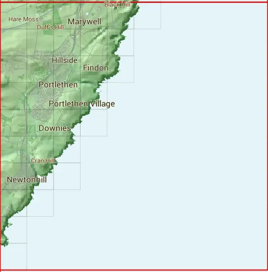
The NO99 10 square kilometre grid intersects with the settlements of Badentoy Park,Cammachmore,Downies,Findon,Marywell,Muchalls,Newtonhill,Portlethen & Portlethen Village.
NO99
NO99 is within the post towns of Aberdeen, Aberdeenshire & Stonehaven, Kincardineshire.
The square is within Aberdeen City & Aberdeenshire councils.
The NO99 national grid square measures 10 km by 10 km and has an area of 1,000 kilometres squared.
The technical term for a 10 km map square is a Hectad.
When this 10 km square is divided into a grid 10 by 10 it gives the next size of grid square. This unit is called a Monad and measures 1km square. 100 monads fit in a 10km square.
Out of the monads generated from square NO99, 1567 are land and -1467 are sea. Sea squares are disregarded on this site as they contain no land features.
|
|
|
|
|
|
 |
|
|
|
 |  |  |  |  |  | ||||
 |  |  |  |  | |||||
 |  |  |  |  | |||||
 |  |  |  | ||||||
 |  |  |  | ||||||
 |  |  | |||||||
 |  |  | |||||||
 |  | ||||||||
 | |||||||||
 |
| Corner | Latitude | Longitude | Easting | Northing |
|---|---|---|---|---|
| South West Corner | 57.001036 | -2.166653 | 390000 | 790000 |
| South East Corner | 57.001036 | -2.001639 | 400000 | 790000 |
| North West Corner | 57.090978 | -2.166653 | 390000 | 800000 |
| North East Corner | 57.090978 | -2.001639 | 400000 | 800000 |