Search for Grid Square by Postcode
NN35
Based in the Highlands and Islands region of Scotland & Mid Scotland and Fife region of Scotland.
NN35
NN35 is within the post towns of Ballachulish, Argyllshire, Bridge Of Orchy, Argyllshire & Pitlochry, Perthshire.
The square is within Argyll and Bute, Highland & Perth and Kinross councils.
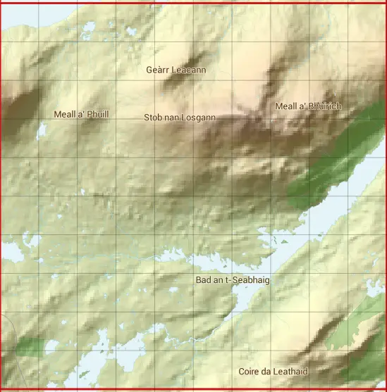
The NN35 national grid square measures 10 km by 10 km and has an area of 1,000 kilometres squared.
The technical term for a 10 km map square is a Hectad.
When this 10 km square is divided into a grid 10 by 10 it gives the next size of grid square. This unit is called a Monad and measures 1km square. 100 monads fit in a 10km square.
Out of the monads generated from square NN35, 523 are land and -423 are sea. Sea squares are disregarded on this site as they contain no land features.
|
|
|
|
|
|
 |
|
|
|
|
|
 |  |  |  |  |  |  |  |  |  |
 |  |  |  |  |  |  |  |  |  |
 |  |  |  |  |  |  |  |  |  |
 |  |  |  |  |  |  |  |  |  |
 |  |  |  |  |  |  |  |  |  |
 |  |  |  |  |  |  |  |  |  |
 |  |  |  |  |  |  |  |  |  |
 |  |  |  |  |  |  |  |  |  |
 |  |  |  |  |  |  |  |  |  |
 |  |  |  |  |  |  |  |  |  |
| Corner | Latitude | Longitude | Easting | Northing |
|---|---|---|---|---|
| South West Corner | 56.610932 | -4.778153 | 230000 | 750000 |
| South East Corner | 56.610932 | -4.608814 | 240000 | 750000 |
| North West Corner | 56.704196 | -4.778153 | 230000 | 760000 |
| North East Corner | 56.704196 | -4.608814 | 240000 | 760000 |