Search for Grid Square by Postcode
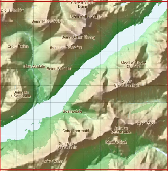
NM87
Based in the Highlands and Islands region of Scotland.
NM87
NM87 is within the post towns of Fort William, Inverness-shire, Glenfinnan, Inverness-shire & Lochailort, Inverness-shire.
The square is within Highland council.
The NM87 national grid square measures 10 km by 10 km and has an area of 1,000 kilometres squared.
The technical term for a 10 km map square is a Hectad.
When this 10 km square is divided into a grid 10 by 10 it gives the next size of grid square. This unit is called a Monad and measures 1km square. 100 monads fit in a 10km square.
Out of the monads generated from square NM87, 317 are land and -217 are sea. Sea squares are disregarded on this site as they contain no land features.
|
|
|
|
|
|
 |
|
|
|
|
|
 |  |  |  |  |  |  |  |  |  |
 |  |  |  |  |  |  |  |  |  |
 |  |  |  |  |  |  |  |  |  |
 |  |  |  |  |  |  |  |  |  |
 |  |  |  |  |  |  |  |  |  |
 |  |  |  |  |  |  |  |  |  |
 |  |  |  |  |  |  |  |  |  |
 |  |  |  |  |  |  |  |  |  |
 |  |  |  |  |  |  |  |  |  |
 |  |  |  |  |  |  |  |  |  |
| Corner | Latitude | Longitude | Easting | Northing |
|---|---|---|---|---|
| South West Corner | 56.769456 | -5.610362 | 180000 | 770000 |
| South East Corner | 56.769456 | -5.438439 | 190000 | 770000 |
| North West Corner | 56.863743 | -5.610362 | 180000 | 780000 |
| North East Corner | 56.863743 | -5.438439 | 190000 | 780000 |
1 KM Squares within the NM87 10 KM Square
NM8070 NM8071 NM8072 NM8073 NM8074 NM8075 NM8076 NM8077 NM8078 NM8079 NM8170 NM8171 NM8172 NM8173 NM8174 NM8175 NM8176 NM8177 NM8178 NM8179 NM8270 NM8271 NM8272 NM8273 NM8274 NM8275 NM8276 NM8277 NM8278 NM8279 NM8370 NM8371 NM8372
NM8373 NM8374 NM8375 NM8376 NM8377 NM8378 NM8379 NM8470 NM8471 NM8472 NM8473 NM8474 NM8475 NM8476 NM8477 NM8478 NM8479 NM8570 NM8571 NM8572 NM8573 NM8574 NM8575 NM8576 NM8577 NM8578 NM8579 NM8670 NM8671 NM8672 NM8673 NM8674 NM8675