Search for Grid Square by Postcode
NM83
Based in the Highlands and Islands region of Scotland.
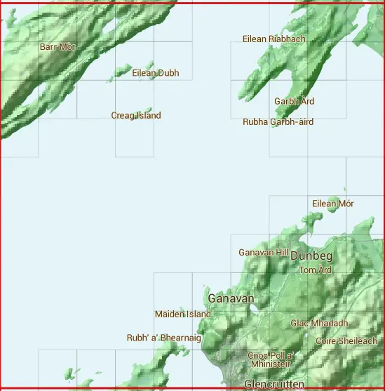
The NM83 10 square kilometre grid intersects with the settlements of Dunbeg,Ganavan & Oban.
NM83
NM83 is within the post town of Oban, Argyllshire.
The square is within Argyll and Bute council.
The NM83 national grid square measures 10 km by 10 km and has an area of 1,000 kilometres squared.
The technical term for a 10 km map square is a Hectad.
When this 10 km square is divided into a grid 10 by 10 it gives the next size of grid square. This unit is called a Monad and measures 1km square. 100 monads fit in a 10km square.
Out of the monads generated from square NM83, 300 are land and -200 are sea. Sea squares are disregarded on this site as they contain no land features.
|
|
|
|
|
|
 |
|
|
|
|
|
 |  |  |  |  |  |  |  | ||
 |  |  |  |  |  |  |  |  | |
 |  |  |  |  |  |  | |||
 |  |  | |||||||
 |  | ||||||||
 |  |  | |||||||
 |  |  |  | ||||||
 |  |  |  |  |  | ||||
 |  |  |  |  |  | ||||
 |  |  |  |  |  |  |  |  |
| Corner | Latitude | Longitude | Easting | Northing |
|---|---|---|---|---|
| South West Corner | 56.410811 | -5.576165 | 180000 | 730000 |
| South East Corner | 56.410811 | -5.405973 | 190000 | 730000 |
| North West Corner | 56.505044 | -5.576165 | 180000 | 740000 |
| North East Corner | 56.505044 | -5.405973 | 190000 | 740000 |