Search for Grid Square by Postcode
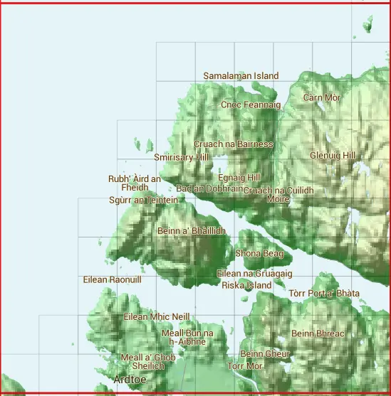
NM67
Based in the Highlands and Islands region of Scotland.
NM67
NM67 is within the post towns of Acharacle, Argyllshire & Lochailort, Inverness-shire.
The square is within Highland council.
The NM67 national grid square measures 10 km by 10 km and has an area of 1,000 kilometres squared.
The technical term for a 10 km map square is a Hectad.
When this 10 km square is divided into a grid 10 by 10 it gives the next size of grid square. This unit is called a Monad and measures 1km square. 100 monads fit in a 10km square.
Out of the monads generated from square NM67, 275 are land and -175 are sea. Sea squares are disregarded on this site as they contain no land features.
|
|
|
|
|
|
 |
|
|
|
|
|
 | |||||||||
 |  |  |  |  |  | ||||
 |  |  |  |  |  | ||||
 |  |  |  |  |  |  | |||
 |  |  |  |  |  |  | |||
 |  |  |  |  |  |  |  | ||
 |  |  |  |  |  |  |  | ||
 |  |  |  |  |  |  |  | ||
 |  |  |  |  |  |  |  |  | |
 |  |  |  |  |  |  |  |  |
| Corner | Latitude | Longitude | Easting | Northing |
|---|---|---|---|---|
| South West Corner | 56.759585 | -5.937584 | 160000 | 770000 |
| South East Corner | 56.759585 | -5.764987 | 170000 | 770000 |
| North West Corner | 56.854267 | -5.937584 | 160000 | 780000 |
| North East Corner | 56.854267 | -5.764987 | 170000 | 780000 |
1 KM Squares within the NM67 10 KM Square
NM6070 NM6171 NM6270 NM6271 NM6272 NM6273 NM6274 NM6370 NM6371 NM6372 NM6373 NM6374 NM6375 NM6376 NM6470 NM6471 NM6472 NM6473 NM6474 NM6475 NM6476 NM6477 NM6478