Search for Grid Square by Postcode
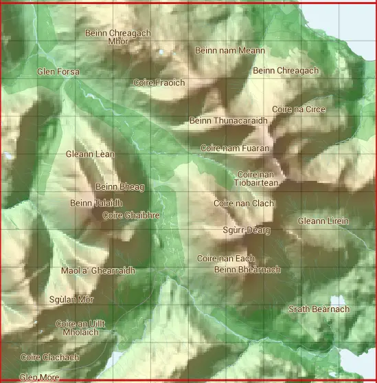
NM63
Based in the Highlands and Islands region of Scotland.
NM63
NM63 is within the post town of Isle Of Mull, Argyllshire.
The square is within Argyll and Bute council.
The NM63 national grid square measures 10 km by 10 km and has an area of 1,000 kilometres squared.
The technical term for a 10 km map square is a Hectad.
When this 10 km square is divided into a grid 10 by 10 it gives the next size of grid square. This unit is called a Monad and measures 1km square. 100 monads fit in a 10km square.
Out of the monads generated from square NM63, 321 are land and -221 are sea. Sea squares are disregarded on this site as they contain no land features.
|
|
|
|
|
|
 |
|
|
|
|
|
 |  |  |  |  |  |  |  |  |  |
 |  |  |  |  |  |  |  |  |  |
 |  |  |  |  |  |  |  |  |  |
 |  |  |  |  |  |  |  |  |  |
 |  |  |  |  |  |  |  |  |  |
 |  |  |  |  |  |  |  |  |  |
 |  |  |  |  |  |  |  |  |  |
 |  |  |  |  |  |  |  |  |  |
 |  |  |  |  |  |  |  |  |  |
 |  |  |  |  |  |  |  |  |  |
| Corner | Latitude | Longitude | Easting | Northing |
|---|---|---|---|---|
| South West Corner | 56.401073 | -5.900306 | 160000 | 730000 |
| South East Corner | 56.401073 | -5.729455 | 170000 | 730000 |
| North West Corner | 56.495695 | -5.900306 | 160000 | 740000 |
| North East Corner | 56.495695 | -5.729455 | 170000 | 740000 |
1 KM Squares within the NM63 10 KM Square
NM6030 NM6031 NM6032 NM6033 NM6034 NM6035 NM6036 NM6037 NM6038 NM6039 NM6130 NM6131 NM6132 NM6133 NM6134 NM6135 NM6136 NM6137 NM6138 NM6139 NM6230 NM6231 NM6232 NM6233 NM6234 NM6235 NM6236 NM6237 NM6238 NM6239 NM6330 NM6331 NM6332
NM6333 NM6334 NM6335 NM6336 NM6337 NM6338 NM6339 NM6430 NM6431 NM6432 NM6433 NM6434 NM6435 NM6436 NM6437 NM6438 NM6439 NM6530 NM6531 NM6532 NM6533 NM6534 NM6535 NM6536 NM6537 NM6538 NM6539 NM6630 NM6631 NM6632 NM6633 NM6634 NM6635