Search for Grid Square by Postcode
NJ02
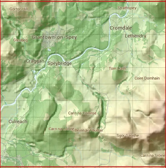
Based in the Highlands and Islands region of Scotland.
The NJ02 10 square kilometre grid intersects with the settlements of Cromdale,Grantown-on-Spey & Nethy Bridge.
NJ02
NJ02 is within the post towns of Ballindalloch, Banffshire, Grantown-on-spey, Morayshire & Nethy Bridge, Inverness-shire.
The square is within Highland & Moray councils.
The NJ02 national grid square measures 10 km by 10 km and has an area of 1,000 kilometres squared.
The technical term for a 10 km map square is a Hectad.
When this 10 km square is divided into a grid 10 by 10 it gives the next size of grid square. This unit is called a Monad and measures 1km square. 100 monads fit in a 10km square.
Out of the monads generated from square NJ02, 465 are land and -365 are sea. Sea squares are disregarded on this site as they contain no land features.
|
|
|
|
|
|
 |
|
|
|
|
|
 |  |  |  |  |  |  |  |  |  |
 |  |  |  |  |  |  |  |  |  |
 |  |  |  |  |  |  |  |  |  |
 |  |  |  |  |  |  |  |  |  |
 |  |  |  |  |  |  |  |  |  |
 |  |  |  |  |  |  |  |  |  |
 |  |  |  |  |  |  |  |  |  |
 |  |  |  |  |  |  |  |  |  |
 |  |  |  |  |  |  |  |  |  |
 |  |  |  |  |  |  |  |  |  |
| Corner | Latitude | Longitude | Easting | Northing |
|---|---|---|---|---|
| South West Corner | 57.259681 | -3.663450 | 300000 | 820000 |
| South East Corner | 57.259681 | -3.493692 | 310000 | 820000 |
| North West Corner | 57.351557 | -3.663450 | 300000 | 830000 |
| North East Corner | 57.351557 | -3.493692 | 310000 | 830000 |