Search for Grid Square by Postcode
NH88
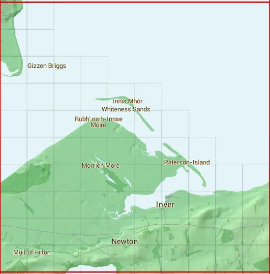
Based in the Highlands and Islands region of Scotland.
The NH88 10 square kilometre grid intersects with the settlements of Dornoch & Inver.
NH88
NH88 is within the post towns of Dornoch, Sutherland & Tain, Ross-shire.
The square is within Highland council.
The NH88 national grid square measures 10 km by 10 km and has an area of 1,000 kilometres squared.
The technical term for a 10 km map square is a Hectad.
When this 10 km square is divided into a grid 10 by 10 it gives the next size of grid square. This unit is called a Monad and measures 1km square. 100 monads fit in a 10km square.
Out of the monads generated from square NH88, 1721 are land and -1621 are sea. Sea squares are disregarded on this site as they contain no land features.
|
|
|
|
|
|
 |
|
|
|
|
|
 |  | ||||||||
 |  | ||||||||
 |  |  |  | ||||||
 |  |  |  |  | |||||
 |  |  |  |  |  |  | |||
 |  |  |  |  |  |  |  | ||
 |  |  |  |  |  |  |  |  |  |
 |  |  |  |  |  |  |  |  |  |
 |  |  |  |  |  |  |  |  |  |
 |  |  |  |  |  |  |  |  |  |
| Corner | Latitude | Longitude | Easting | Northing |
|---|---|---|---|---|
| South West Corner | 57.793485 | -4.025359 | 280000 | 880000 |
| South East Corner | 57.793485 | -3.852210 | 290000 | 880000 |
| North West Corner | 57.885827 | -4.025359 | 280000 | 890000 |
| North East Corner | 57.885827 | -3.852210 | 290000 | 890000 |
1 KM Squares within the NH88 10 KM Square
NH8080 NH8081 NH8082 NH8083 NH8084 NH8085 NH8087 NH8088 NH8089 NH8180 NH8181 NH8182 NH8183 NH8184 NH8185 NH8186 NH8187 NH8188 NH8189 NH8280 NH8281 NH8282
NH8283 NH8284 NH8285 NH8286 NH8287 NH8380 NH8381 NH8382 NH8383 NH8384 NH8385 NH8386 NH8387 NH8480 NH8481 NH8482 NH8483 NH8484 NH8485 NH8486 NH8580 NH8581