Search for Grid Square by Postcode
NH76
Based in the Highlands and Islands region of Scotland.
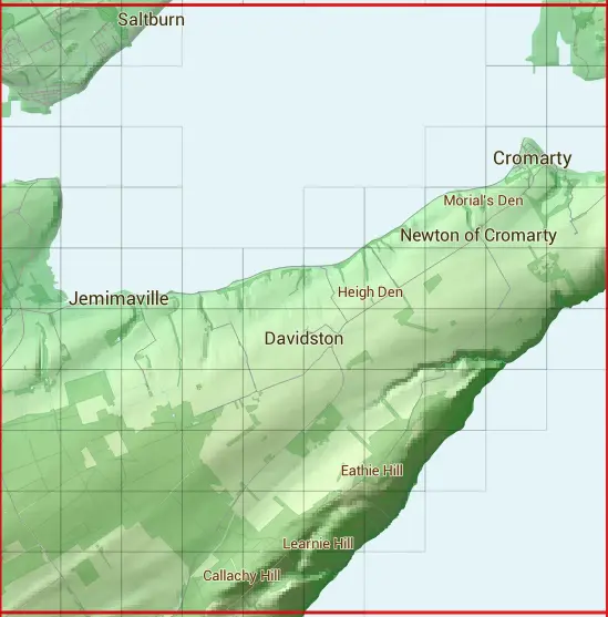
The NH76 10 square kilometre grid intersects with the settlements of Balblair,Cromarty,Davidston,Invergordon & Jemimaville.
NH76
NH76 is within the post towns of Cromarty, Ross-shire, Dingwall, Ross-shire, Fortrose, Ross-shire, Invergordon, Ross-shire & Tain, Ross-shire.
The square is within Highland council.
The NH76 national grid square measures 10 km by 10 km and has an area of 1,000 kilometres squared.
The technical term for a 10 km map square is a Hectad.
When this 10 km square is divided into a grid 10 by 10 it gives the next size of grid square. This unit is called a Monad and measures 1km square. 100 monads fit in a 10km square.
Out of the monads generated from square NH76, 448 are land and -348 are sea. Sea squares are disregarded on this site as they contain no land features.
|
|
|
|
|
|
 |
|
|
|
|
|
 |  |  |  |  | |||||
 |  |  |  | ||||||
 |  |  |  |  |  | ||||
 |  |  |  |  |  |  |  | ||
 |  |  |  |  |  |  |  |  |  |
 |  |  |  |  |  |  |  |  |  |
 |  |  |  |  |  |  |  |  | |
 |  |  |  |  |  |  |  | ||
 |  |  |  |  |  |  | |||
 |  |  |  |  |  |
| Corner | Latitude | Longitude | Easting | Northing |
|---|---|---|---|---|
| South West Corner | 57.611179 | -4.182991 | 270000 | 860000 |
| South East Corner | 57.611179 | -4.010347 | 280000 | 860000 |
| North West Corner | 57.703719 | -4.182991 | 270000 | 870000 |
| North East Corner | 57.703719 | -4.010347 | 280000 | 870000 |