Search for Grid Square by Postcode
NH54
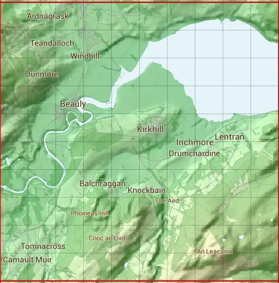
Based in the Highlands and Islands region of Scotland.
The NH54 10 square kilometre grid intersects with the settlements of Beauly,Inchmore,Kiltarlity,Kirkhill,Muir of Ord & Windhill.
NH54
NH54 is within the post towns of Beauly, Inverness-shire, Inverness, Inverness-shire & Muir Of Ord, Ross-shire.
The square is within Highland council.
The NH54 national grid square measures 10 km by 10 km and has an area of 1,000 kilometres squared.
The technical term for a 10 km map square is a Hectad.
When this 10 km square is divided into a grid 10 by 10 it gives the next size of grid square. This unit is called a Monad and measures 1km square. 100 monads fit in a 10km square.
Out of the monads generated from square NH54, 511 are land and -411 are sea. Sea squares are disregarded on this site as they contain no land features.
|
|
|
|
|
|
 |
|
|
|
|
|
 |  |  |  |  |  |  |  |  |  |
 |  |  |  |  |  |  |  |  |  |
 |  |  |  |  |  |  |  |  |  |
 |  |  |  |  |  |  |  |  |  |
 |  |  |  |  |  |  |  |  |  |
 |  |  |  |  |  |  |  |  |  |
 |  |  |  |  |  |  |  |  |  |
 |  |  |  |  |  |  |  |  |  |
 |  |  |  |  |  |  |  |  |  |
 |  |  |  |  |  |  |  |  |  |
| Corner | Latitude | Longitude | Easting | Northing |
|---|---|---|---|---|
| South West Corner | 57.425493 | -4.505844 | 250000 | 840000 |
| South East Corner | 57.425493 | -4.333331 | 260000 | 840000 |
| North West Corner | 57.518436 | -4.505844 | 250000 | 850000 |
| North East Corner | 57.518436 | -4.333331 | 260000 | 850000 |