Search for Grid Square by Postcode
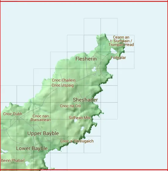
NB53
Based in the Highlands and Islands region of Scotland.
The NB53 10 square kilometre grid intersects with the settlements of Aird,Garrabost,Knock,Lower Bayble,Pabail Uarach,Portvoller & Sulaisiadar.
NB53
NB53 is within the post town of Isle Of Lewis, Ross-shire.
The square is within Na h-Eileanan an Iar council.
The NB53 national grid square measures 10 km by 10 km and has an area of 1,000 kilometres squared.
The technical term for a 10 km map square is a Hectad.
When this 10 km square is divided into a grid 10 by 10 it gives the next size of grid square. This unit is called a Monad and measures 1km square. 100 monads fit in a 10km square.
Out of the monads generated from square NB53, 180 are land and -80 are sea. Sea squares are disregarded on this site as they contain no land features.
|
|
|
|
|
|
 |
|
|
|
|
 |  | ||||||||
 |  |  |  | ||||||
 |  |  |  |  | |||||
 |  |  |  |  | |||||
 |  |  |  |  |  |  | |||
 |  |  |  |  |  |  | |||
 |  |  |  |  |  | ||||
 |  |  |  |  |  | ||||
 |  |  |  |
| Corner | Latitude | Longitude | Easting | Northing |
|---|---|---|---|---|
| South West Corner | 58.187719 | -6.265803 | 150000 | 930000 |
| South East Corner | 58.187719 | -6.085420 | 160000 | 930000 |
| North West Corner | 58.282856 | -6.265803 | 150000 | 940000 |
| North East Corner | 58.282856 | -6.085420 | 160000 | 940000 |